Aqualux II, a video installation by 2005 CSIRO Synapse artist in residence, Peter E. Charuk, represents the Southern Ocean seabed. Reviewed on the CSIRO website, it is described as ‘landscape’. (Synapse Art and Science Residency – Exhibition 2005, 2005, Online accessed 25 May 2007):
With this work, from an artist who has observed and learned from scientists, reams of scientific data are synthesized into a video presentation showing hidden landscapes and an insight into scientific processes used in seabed mapping.
.
Charuk aims to reveal unseen landscapes of our day-to-day existence:
People continue to work in their familiar environment and do not “see” what is interesting in their day-to-day existence. As an artist, I am interested in focusing on what is there as “evidence” of this (unseen) reality.
.
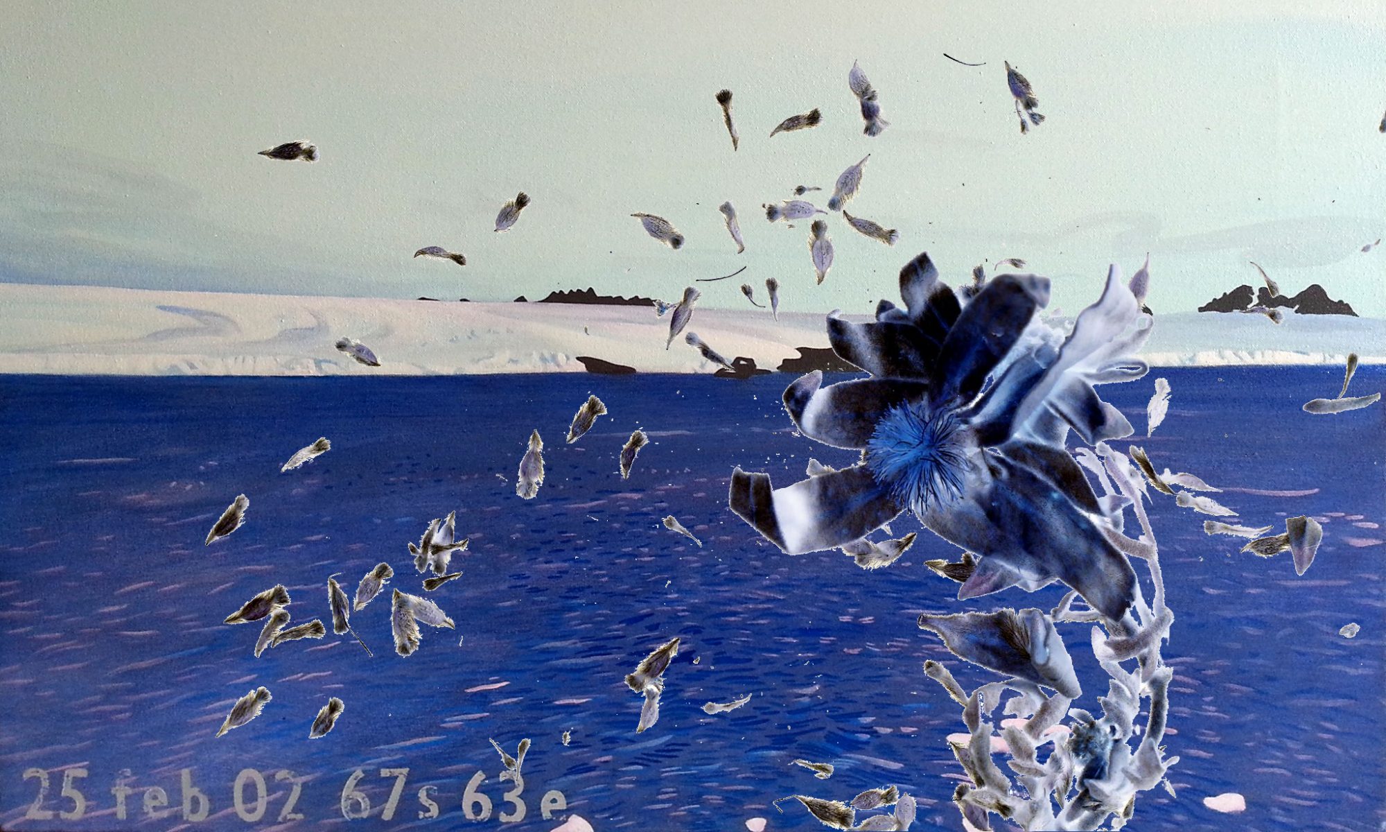
Viewing Charuk’s Aqualux II at the ‘Synapse – Focus on Art and Science’ display in the Sydney offices of The Australia Council for the Arts on 7 March this year, I recognized the footage as that which I had studied, to etch Antarctic sea life into Perspex.
The video footage taken by a camera which had been trawled beneath the Australian icebreaker, Aurora Australis, during an oceanographic expedition around Heard Island in 2004.
My partner had worked with that particular expedition, and I was working in the Multimedia department of the Australian Antarctic Division when the footage arrived. I watched and drew the extraordinary life forms, which had been captured on video for the first time.
.
Our source material was the same, and our response quite similar. I relate to Charuk’s desire to present the ‘unseen’ landscape as part of our world. Attributing exotic status to Antarctic landscape does not bring it closer to our understanding; it works against it. On the other hand, rendering familiar landscapes more exotic may be possible by drawing links between them and such ‘unseen’ landscapes beneath the ocean floor.
The ways we worked with this beautiful material however, varied greatly, shaped in part perhaps by the possibilities offered by our chosen media.
.
Charuk used digital editing techniques to make composite images, as Frank Hurley had done for similarly dramatic and engaging effects. Juxtaposing forms provides reference points in an otherwise ‘sea’ of information, heightening the sense of the scale we have to deal with in the Antarctic. He also compressed time, omitting the endless repetition of the raw footage to provide reference points in time as well as space. Most arrestingly, he slowed the motion right down at times, allowing our gaze to pause on the fleeting forms. Like the scientists, he works to render the unseen seen, the unknown landscape mapped, and known in ways that can be read.
.
Ensconced in a small lab at the Australian Antarctic Division in 2003, I watched video footage of strange animals and plant forms glowing in the unnatural light cast upon them from a ship. I drew with the excitement of seeing things that had never been seen before. I drew quickly with pencil on paper as the raw video footage played in real time, imagining myself in the moment the camera was seeing. The images had only just returned from the icebreaker Aurora Australis, beneath which a camera had eyed the ocean floor around Heard Island for the first time.
Later, these drawings were then etched into Perspex blocks retrieved from Sydney’s Reverse Garbage, and on fluorescent offcuts from Sydney University science lab. I want people to see the places we occupy in cities, and our impact on these, within the context of the Antarctic landscape.
.
.